
Understanding the Atmosphere
A Complete Guide to Weather Systems, Cloud Formation, and Weather Prediction for Paragliding Students
A Practical Meteorology Lecture for Bir Billing Paragliders
Welcome to this comprehensive meteorology lesson designed specifically for paragliding students. As a paraglider, the atmosphere is not just your environment—it is your aircraft. Understanding it can be the difference between an extraordinary flight and a dangerous situation.
Part 1: The Fundamental Physics of Cloud Formation
The Three Essential Ingredients for Clouds
Cloud formation is similar to baking a cake—you need the right ingredients. Clouds require exactly three components:
- Moisture (water vapor)
- Cooling of air
- Condensation nuclei
Moisture
The sun evaporates water from oceans, lakes, soil, and vegetation, turning liquid water into invisible water vapor. Warm air can hold more moisture than cold air.
Cooling and Adiabatic Lapse Rate
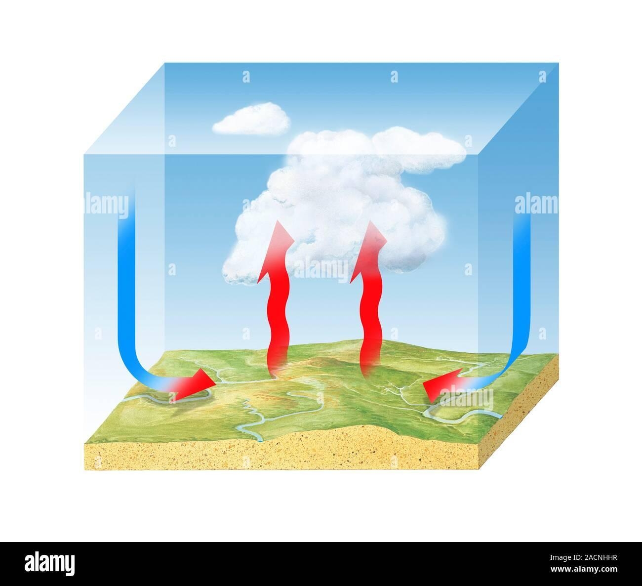
As warm air rises, atmospheric pressure decreases, allowing the air to expand and cool. This process is called adiabatic cooling.
- Dry air cools at ~9.8°C per 1,000 meters
- Moist air cools at ~6°C per 1,000 meters
☁️ Lifting Condensation Level (LCL)
The altitude where rising air cools to its dew point and cloud formation begins.
Condensation Nuclei
Water vapor requires microscopic particles like dust, salt, or smoke to condense. Without these, clouds cannot form naturally.
Relative Humidity & Dew Point
Dew point is the temperature at which condensation begins. Relative humidity measures how close the air is to saturation.
Part 2: Atmospheric Stability and Cloud Types
Stable vs Unstable Atmosphere
Atmospheric stability determines whether air continues to rise or sinks back. It's determined by comparing the environmental lapse rate (how temperature actually decreases with altitude in the real atmosphere) with the dry adiabatic lapse rates (how quickly a rising air parcel cools).
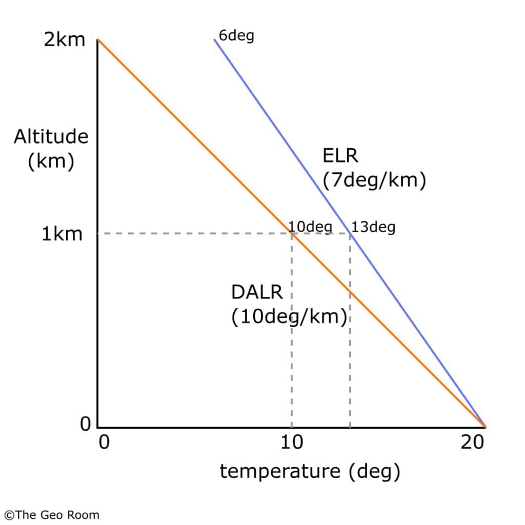
- Stable air: Weak vertical motion, flat clouds. ELR < DALR
- Unstable air: Strong thermals, towering clouds. ELR > DALR
- Inversion: Acts as a lid, suppressing thermals
Cloud Types by Altitude
High-Altitude Clouds (Above 6,000 m)
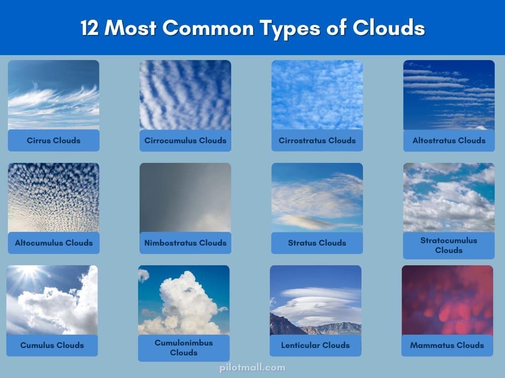
- Cirrus – thin, wispy, weather change indicator
- Cirrostratus – halo-producing sheets
- Cirrocumulus – instability aloft
Mid-Altitude Clouds (2,000–6,000 m)
- Altocumulus – puffy layers, unstable mid-levels
- Altostratus – rain within hours
- Nimbostratus – steady precipitation
Low-Altitude Clouds (Below 2,000 m)
- Cumulus – thermals and lift
- Stratus – stable, poor flying
- Stratocumulus – mild convection
Part 3: Special Cloud Features
Clouds with Vertical Development
- Cumulus Congestus: Strong thermals, instability
- Cumulonimbus: Thunderstorms – avoid completely
Virga
Precipitation that evaporates before reaching the ground. Indicates moisture aloft and dry air below.
Lenticular Clouds
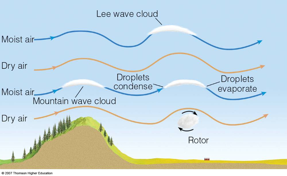
Lens-shaped clouds formed by mountain waves. Indicate strong winds and wave lift.
Rotor Clouds
Turbulent clouds on the lee side of mountains. Extremely dangerous for paragliding.
Part 4: Using Cloud Physics to Predict Weather
Cloud Base Height Formula
Cloud Base (meters) = (Temperature − Dew Point) × 125
📐 Example
Temp: 22°C, Dew Point: 8°C → Spread: 14°C
Cloud Base ≈ 1,750 meters MSL
Pressure Systems
- High Pressure: Stable, good flying
- Low Pressure: Instability, clouds, rain
Fronts
- Warm Front – gradual deterioration
- Cold Front – storms, then improved conditions
- Stationary Front – persistent marginal weather
Part 5: Practical Weather Prediction Using Clouds
Signs of Improving Conditions
- Fair-weather cumulus
- Clear cloud bases
- Weak winds
Signs of Deteriorating Conditions
- Thickening cirrus
- Vertical cloud growth
- Wind shear
- Dark cloud bases
Part 6: Practical Exercises for Bir Billing Paragliders
Exercise 1: Cloud Base Calculation
Use Windy app temperature and dew point data to calculate cloud base daily.
Exercise 2: Cloud Type Observation
Observe clouds throughout the day and track their evolution.
Exercise 3: Frontal Recognition
Monitor cloud progression over multiple days to identify fronts.
Exercise 4: Stability Assessment
Evaluate cloud shape, growth rate, and base clarity to assess instability.
Exercise 5: Pre-Flight Weather Briefing
Perform a structured weather check before every flight.
⚠️ Final Reminder
Never rely on cloud observation alone. Always consult official forecasts and respect the power of the atmosphere.
Conclusion: From Theory to Safe Skies
Every cloud tells a story. Learn to read it, integrate observations with forecasts, and build experience. This knowledge transforms paragliders into confident, safe pilots.